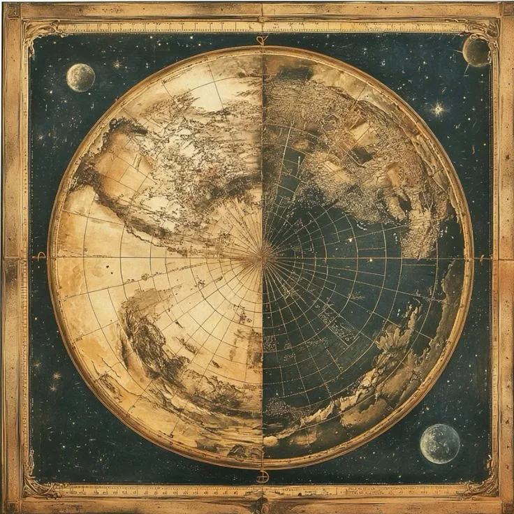
Historical maps for collectors offer a fascinating way to explore the world through the eyes of earlier generations. Every antique map represents a unique moment in history, reflecting how people understood geographical locations, discovered new territories, established trade routes, and documented changing borders. Beyond their practical purpose, these maps are valuable historical objects that combine artistic craftsmanship, geographical knowledge, and cultural heritage.
For collectors, historical maps provide an opportunity to own something that connects the present with the past. Some feature beautifully illustrated coastlines, mountains, rivers, and cities, while others highlight important discoveries, political boundaries, and historical journeys. Whether displayed in a private collection, preserved as family heirlooms, or studied for educational purposes, old maps offer lasting appeal.
Building a collection of historical maps is not simply about purchasing old paper. It involves understanding different periods, recognizing printing techniques, researching geographical details, and appreciating the stories behind individual pieces. With the right knowledge, collectors can develop meaningful collections that reflect their personal interests and historical curiosity.
Why Historical Maps Attract Collectors
Historical maps have a special appeal because they combine information and visual beauty. Unlike ordinary decorative artwork, each map provides an authentic representation of geographical understanding during a particular period. It shows how earlier societies described their surroundings and how geographical knowledge developed over time.
Collectors are often attracted to maps because of their historical importance. A map created several centuries ago may illustrate boundaries that no longer exist, cities that have changed their names, or geographical features that were once understood differently. These details make every piece an interesting subject for research and discussion.
Artistic presentation is another important reason behind their popularity. Many historical maps feature decorative borders, elaborate lettering, illustrated sailing ships, compass roses, and detailed cartouches. These features demonstrate the creativity and craftsmanship of earlier mapmakers.
Some collectors focus on geographical accuracy, while others prefer maps with exceptional illustrations or connections to particular historical events. This variety makes the collecting experience flexible and rewarding.
Understanding Different Types of Historical Maps
Historical maps are available in many styles and formats. Understanding their differences helps collectors identify pieces that suit their interests and collection goals.
Antique World Maps
Antique world maps are among the most recognizable pieces in historical cartography. They present geographical knowledge from different centuries and reveal how mapmakers understood continents, oceans, and distant territories.
Older world maps sometimes include geographical interpretations that differ significantly from modern representations. Continents may appear with unusual proportions, coastlines may be incomplete, and certain regions may be represented according to limited information available at the time.
These characteristics make antique world maps particularly interesting. Collectors can compare examples from different periods to understand how exploration and geographical research influenced the representation of the planet.
Historical City Maps
Historical city maps provide detailed views of towns, settlements, streets, landmarks, and architectural features. They are especially attractive to collectors interested in urban development and local history.
A city map may reveal how a settlement expanded, where important public buildings were located, and how transportation routes connected different neighbourhoods. Some examples include illustrations of prominent structures, defensive walls, harbours, and marketplaces.
Collectors interested in family history or a particular location often find these maps meaningful because they offer a glimpse into the appearance of familiar places many generations ago.
Nautical Maps and Sea Charts
Nautical maps, also known as historical sea charts, document maritime routes, coastlines, ports, islands, and navigational information.
These maps played an important role in international trade, exploration, and ocean travel. Their illustrations often include compass roses, directional lines, coastal details, and references to important maritime destinations.
For collectors fascinated by naval history, shipping, and exploration, historical sea charts provide an excellent collecting category.
Regional and Country Maps
Regional maps focus on particular countries, provinces, territories, and geographical areas. They often document political divisions, administrative boundaries, rivers, roads, and settlements.
Their historical significance can be particularly strong when they represent regions during periods of political transformation. Collectors can discover how national borders changed and how geographical identities developed over time.
The Historical Stories Behind Old Maps
One of the most rewarding aspects of collecting historical maps is discovering the stories they preserve. Maps were created for different reasons, including navigation, education, administration, military planning, trade, and exploration.
During earlier centuries, geographical information was gathered through journeys, written accounts, maritime observations, and the work of professional surveyors. Mapmakers combined available information to produce representations that helped people understand distant places.
The development of printing also transformed map production. Engraving techniques allowed detailed geographical information and decorative illustrations to be reproduced more widely. Copperplate engraving became particularly important for producing finely detailed maps.
As geographical knowledge expanded, mapmakers updated their representations. New coastlines appeared, previously unfamiliar territories received greater attention, and established geographical assumptions were revised.
For collectors, examining these changes creates an opportunity to follow the development of human knowledge through original historical documents.
How to Identify Valuable Historical Maps
Not every old-looking map is necessarily an antique or a valuable collectible. Understanding its origin, production method, age, and condition is important when evaluating a potential purchase.
Research the Mapmaker
The identity of the mapmaker can provide useful information about a map's historical importance. Some cartographers became well known for their geographical publications, detailed engravings, or contributions to the development of cartography.
Researching the creator can help establish the period in which a map was produced and identify the publishing house associated with it.
However, collectors should remember that a famous mapmaker's name does not automatically establish that an individual example is an original historical impression. Later editions and reproductions may also carry the original cartographer's name.
Examine the Printing Technique
Printing methods provide important clues about the production history of a map.
Copperplate engraving was widely used for producing detailed maps, with lines and geographical features engraved into metal plates. Woodcut printing was another historical method, often recognizable through its distinctive appearance.
Lithography became increasingly popular during later periods because it allowed images and text to be reproduced efficiently.
Understanding these methods helps collectors distinguish between different historical printing traditions and recognize modern reproductions.
Check Publication Details
Many historical maps contain information about their publishers, engravers, dates, or places of publication. These details may appear along the lower border, inside a decorative cartouche, or near the map's title.
Such information can help collectors research the original publication and determine whether the map belongs to a particular edition.
When publication details are missing, specialist references and professional opinions can help establish a more reliable identification.
The Importance of Condition and Preservation
Condition has a considerable influence on the desirability of historical maps. Since many examples were printed on paper, they require careful handling and suitable storage.
Collectors should examine the paper for tears, folds, stains, missing sections, fading, and previous repairs. Some signs of age are expected in genuine historical documents, but extensive damage can affect both presentation and long-term preservation.
Proper storage is essential. Maps should be kept away from direct sunlight, excessive moisture, and environments with significant temperature fluctuations. Acid-free materials and archival-quality protective folders can help support their long-term condition.
Large maps may require professional mounting or framing. Using appropriate protective materials and suitable framing methods helps preserve the original paper while making the artwork suitable for display.
Collectors should avoid unnecessary cleaning, trimming, or restoration. Any conservation work should be discussed with a qualified paper conservator who understands historical documents.
Building a Meaningful Historical Map Collection
Creating a successful collection begins with a clear direction. Rather than purchasing unrelated pieces without research, collectors can choose a theme that reflects their interests.
Some prefer maps from a particular century, while others concentrate on specific countries, cities, maritime exploration, or historical events.
A themed collection provides a stronger sense of continuity. For example, someone interested in European history might collect maps showing the development of regional boundaries over several centuries.
Another collector may focus on world maps and compare how different cartographers represented continents during the age of exploration.
There is also an opportunity to create collections around artistic characteristics. Maps with decorative borders, illustrated ships, elaborate titles, and distinctive typography can form an attractive visual collection.
Whatever direction collectors choose, maintaining accurate records is important. Details such as the map's title, estimated publication date, cartographer, publisher, dimensions, printing method, and purchase information should be documented.
This information makes it easier to organize the collection and understand the background of each piece.
Where to Find Historical Maps for Collectors
Finding suitable historical maps requires patience and careful research. Collectors can explore specialist antique map dealers, established auction houses, historical bookshops, estate collections, and reputable online marketplaces.
Specialist dealers are particularly useful because they may provide detailed descriptions, historical references, and information about condition. Experienced sellers can also help collectors understand differences between original impressions, later editions, and reproductions.
Auction houses offer another opportunity to discover unusual pieces. However, buyers should carefully review catalogue descriptions, condition reports, and available provenance information before making a purchase.
Online collections have also made historical maps more accessible. Digital catalogues allow collectors to explore different geographical periods and compare examples before deciding which pieces deserve further investigation.
When purchasing online, clear photographs are important. Buyers should request images showing the complete map, printed details, margins, reverse side, and any visible damage.
It is also sensible to confirm whether the item is an original historical print or a modern decorative reproduction.
Understanding Authenticity and Provenance
Authenticity is one of the most important considerations in historical map collecting. An attractive map may look old, but its appearance alone cannot establish its actual age or historical origin.
Provenance refers to the documented history of ownership or origin of an item. When available, provenance can help collectors understand where a map came from and how it entered the market.
Original publication information, historical catalogues, specialist references, and previous ownership records can all contribute to the identification process.
Collectors should be particularly careful when purchasing expensive or rare maps. If the item's authenticity is uncertain, seeking an independent opinion from a qualified specialist is a sensible step.
Reproductions also have a place in the market. They can be attractive decorative objects and offer an accessible way to enjoy historical cartography. However, they should always be described accurately so buyers understand what they are purchasing.
Displaying Historical Maps as Decorative Artwork
Historical maps are not only valuable research materials; they can also become impressive decorative features in homes, offices, libraries, and professional spaces.
A carefully selected map can create a distinctive atmosphere while reflecting an interest in geography, exploration, or cultural heritage.
Large world maps work particularly well as statement pieces in spacious rooms. Smaller regional maps can be displayed together to create a themed gallery wall.
Framing should always consider preservation requirements. Archival-quality mounting materials, protective glazing, and suitable backing can help reduce exposure to environmental damage.
Lighting also deserves attention. Direct sunlight can gradually fade printed details and affect paper quality. Displaying historical maps in areas with controlled lighting helps maintain their appearance.
Collectors may also rotate displayed pieces rather than keeping their entire collection permanently exposed.
The Educational Value of Historical Cartography
Historical maps provide valuable educational opportunities for students, researchers, historians, and geography enthusiasts.
They demonstrate how geographical understanding changed as people explored unfamiliar regions and developed more accurate surveying methods.
Comparing maps from different centuries can reveal changes in political boundaries, transportation networks, settlement patterns, and place names.
Teachers can use historical maps to introduce subjects such as world exploration, international trade, urban development, and cultural exchange.
Researchers may examine old maps to investigate historical landscapes, former waterways, settlement locations, and the development of particular regions.
For families, collecting historical maps can also become a shared learning activity. Exploring the history of a particular city or country through old cartographic documents encourages curiosity and creates meaningful conversations across generations.
Collecting Rare and Unusual Historical Maps
Some collectors are particularly interested in unusual maps that represent distinctive historical circumstances. These may include early regional surveys, limited publication editions, maps associated with important journeys, or unusual geographical interpretations.
Rarity can contribute to a map's desirability, but it should not be considered the only measure of importance.
Historical relevance, visual appeal, publication history, condition, and documented authenticity all deserve attention.
A relatively common map with an interesting connection to local history may be more meaningful to a particular collector than a scarce example from an unrelated region.
The best collections often combine research, personal interest, and careful selection rather than focusing exclusively on market value.
Common Mistakes to Avoid When Collecting
New collectors sometimes purchase maps based entirely on appearance without researching their origin. This can lead to confusion between original historical prints and modern reproductions.
Another common mistake is overlooking condition. A map with missing margins, extensive staining, or previous alterations may require professional conservation before it can be displayed appropriately.
Collectors should also avoid assuming that every map described as rare is genuinely scarce. Reliable references and comparisons with other examples provide a better understanding of rarity.
Purchasing without checking dimensions can also create problems, especially when collectors intend to frame or display a particular piece.
Finally, maps should not be treated as ordinary decorative paper. Their historical and cultural significance makes careful handling and preservation essential.
The Future of Historical Map Collecting
Interest in historical cartography continues to connect traditional collecting with modern research and digital technology.
Online catalogues, high-resolution digital images, and historical archives allow people to study maps from different parts of the world without needing immediate access to physical collections.
Digital resources also make it easier to compare geographical representations from different periods. Collectors can investigate historical place names, identify changes in borders, and research the work of individual cartographers.
Despite these developments, original historical maps retain a special appeal. Their physical paper, printing characteristics, handwritten annotations, and visible signs of age provide an experience that digital images cannot fully reproduce.
As interest in cultural heritage and historical documentation continues, original maps remain meaningful objects for collectors, researchers, and art enthusiasts.
Conclusion
Historical maps for collectors represent an exciting combination of geographical knowledge, artistic craftsmanship, and historical storytelling. Each map offers a glimpse into how earlier generations understood the world and documented the places around them.
From antique world maps and detailed city plans to nautical charts and regional surveys, collectors can explore numerous categories while developing collections that reflect their individual interests.
Successful collecting requires more than finding attractive pieces. Understanding authenticity, researching mapmakers, examining printing techniques, evaluating condition, and maintaining suitable storage practices all contribute to a rewarding experience.
Whether someone is beginning a small collection or expanding an established archive, historical maps offer an enduring connection to the past. Their geographical details, decorative features, and historical significance make them fascinating objects to discover, preserve, study, and appreciate for generations to come.