

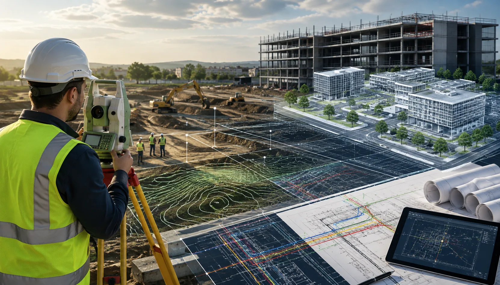
Before architects can design a building and engineers can develop a site, they need accurate information about the land.
Property boundaries, elevations, existing structures, roads, utilities, easements, and other site features can all influence how a project is planned and constructed. This information usually begins with a land survey, but survey data becomes much more useful when it is organized into clear, accurate digital drawings.
This is where land survey drafting plays an important role.
Land survey drafting converts survey measurements and field data into technical drawings that architects, engineers, developers, contractors, and other professionals can use for planning and design.
What Is Land Survey Drafting?
Land survey drafting is the process of creating digital survey drawings from field measurements, survey data, and other property information.
Depending on the project, survey drawings may show:
- Property boundaries
- Existing buildings
- Roads and driveways
- Elevations
- Utilities
- Easements
- Fences and walls
- Trees and vegetation
- Drainage features
- Topographic information
- Right-of-way information
The purpose is to turn raw survey information into an organized drawing that can be easily understood and used by other project teams.
Why Is Land Survey Drafting Important?
A construction project depends on accurate information about existing conditions.
If the base information is incomplete or difficult to interpret, design teams may make incorrect assumptions about the property.
Accurate survey drafting can help project teams:
- Understand existing site conditions
- Identify property constraints
- Plan building locations
- Coordinate utilities
- Develop grading plans
- Support land development design
- Reduce design revisions
- Improve communication between disciplines
In simple terms, survey drafting provides a reliable digital foundation for many later design decisions.
What Information Does a Survey Drawing Contain?
The contents depend on the survey type and project requirements.
A typical survey drawing may include several categories of information.
Property Boundaries
Boundary information defines the limits of a property and may include bearings, distances, monuments, easements, and other relevant information.
Existing Features
Existing buildings, pavements, fences, walls, driveways, trees, and other visible features may be documented.
Elevations
Topographic information shows changes in ground elevation across the site.
Utilities
Known water, sewer, stormwater, electrical, gas, and communication utilities may be shown when available.
Easements and Rights-of-Way
These can affect where development or construction can occur.
Survey Control
Control points and other reference information help maintain consistency throughout the project.
What Are the Main Types of Land Survey Drafting?
Different projects require different survey drawings.
Boundary Survey Drafting
Boundary drawings focus on property limits and related legal information.
They can be important for property development, land transactions, planning, and construction.
Topographic Survey Drafting
Topographic drawings document terrain and existing physical features.
They are particularly useful for civil engineering, grading, drainage, roadway, and land development projects.
ALTA/NSPS Survey Drafting
ALTA/NSPS surveys are commonly associated with commercial real estate transactions in the United States.
They can document boundaries, improvements, easements, rights-of-way, and other property-related information according to applicable standards.
Utility Survey Drafting
Utility information can help project teams understand existing infrastructure before designing new systems or beginning excavation.
As-Built Survey Drafting
As-built surveys document conditions after construction or installation.
They can support future maintenance, modifications, and facility documentation.
How Does Land Survey Drafting Work?
A typical digital survey drafting workflow involves several stages.
1. Collect Survey Information
Survey data may come from field measurements, total stations, GPS/GNSS equipment, laser scanning, drones, existing drawings, and other sources.
2. Review the Data
The available information is reviewed for completeness, consistency, coordinates, units, and project requirements.
3. Create the Digital Drawing
Survey information is organized into a CAD or other appropriate digital environment.
4. Organize Layers
Different types of information can be separated into logical layers.
For example:
- Property
- Existing buildings
- Utilities
- Roads
- Topography
- Vegetation
- Annotation
A well-organized layer structure makes drawings easier to review and edit.
5. Add Labels and Annotations
Important information such as elevations, dimensions, descriptions, and survey notes is added to the drawing.
6. Quality Control
The completed drawing is checked against the available survey information to identify inconsistencies or missing elements.
7. Deliver the Final Drawing
The final survey drawing is delivered in the format required by the project team.
How Do Architects Use Survey Drawings?
Architects need to understand the site before developing a building design.
Survey drawings can help architects determine:
- Where the property begins and ends
- Where existing buildings are located
- How the terrain changes
- Where access points exist
- Which site features must be preserved
- Where setbacks or easements may affect the design
A building that looks appropriate on a conceptual plan may not work once real site conditions are considered.
Survey information therefore helps architects develop designs that respond to the actual property.
How Do Civil Engineers Use Survey Drafting?
Civil engineers often use survey drawings as the starting point for site development.
Survey information can support:
- Grading design
- Drainage design
- Stormwater management
- Roadway design
- Utility planning
- Site development
- Earthwork analysis
- Construction documentation
For example, engineers need existing elevations to develop an appropriate grading strategy.
Without reliable topographic information, drainage and site grading decisions become much more difficult.
How Do Developers Benefit From Survey Drafting?
Developers need to understand the opportunities and constraints of a property before investing heavily in development.
Survey drawings can help them evaluate:
- Buildable areas
- Property boundaries
- Existing improvements
- Access
- Utility availability
- Terrain
- Easements
- Development constraints
This information can support better early-stage planning and reduce the likelihood of discovering important site conditions too late.
How Does Technology Improve Survey Drafting?
Modern surveying generates far more digital information than traditional workflows.
CAD
CAD software allows survey information to be organized into accurate, editable technical drawings.
GIS
GIS can connect survey information with geographic and environmental data.
LiDAR
LiDAR can capture detailed three-dimensional information about terrain and physical features.
Drone Surveying
Drone-based photogrammetry can provide aerial imagery and spatial information for appropriate projects.
Point Clouds
Laser scanning can produce dense point-cloud data that represents existing physical conditions.
These technologies can improve the amount and quality of information available to project teams, but proper processing and drafting remain essential.
What Is the Difference Between Surveying and Survey Drafting?
Surveying and survey drafting are related but different activities.
Land surveying involves collecting, establishing, and verifying information about a property and its physical or legal characteristics.
Survey drafting involves converting that information into organized technical drawings.
A simplified workflow is:
Field Survey → Survey Data → Processing → Drafting → Digital Survey Drawing → Design
Both stages contribute to the quality of the final project information.
What Problems Can Poor Survey Documentation Cause?
Poor or incomplete survey documentation can create problems throughout a project.
Potential issues include:
- Incorrect building placement
- Boundary misunderstandings
- Utility conflicts
- Grading problems
- Drainage issues
- Design revisions
- Construction delays
- Additional field surveys
- Increased project costs
Not every problem originates from drafting. However, unclear or inaccurate documentation can make it harder for project teams to identify and address site constraints early.
How Does Survey Drafting Support Land Development?
Land development requires multiple disciplines to work from a common understanding of the property.
A development project may involve:
- Surveyors
- Civil engineers
- Architects
- Structural engineers
- Landscape designers
- Utility consultants
- Environmental professionals
- Contractors
Survey drawings provide a common reference for many of these teams.
For example, the architect may use the survey to establish the building location, while the civil engineer uses the same information to develop grading, drainage, and utility plans.
This coordination can help reduce conflicting assumptions.
Can Survey Data Be Used With BIM?
Yes.
Survey information can be integrated into broader CAD, GIS, BIM, and reality-capture workflows.
For complex projects, survey information can provide a spatial foundation for coordinating:
- Buildings
- Roads
- Utilities
- Terrain
- Existing structures
- Site improvements
This can create a more connected digital project environment.
What Should You Look for in a Survey Drafting Provider?
Organizations outsourcing survey drafting should evaluate several factors.
Technical Capability
The provider should understand survey drawings, CAD standards, coordinate systems, and project documentation.
Relevant Experience
Experience with the required survey type and project category is important.
Quality Control
A structured review process can help identify missing information and drafting inconsistencies.
Software Compatibility
The provider should be able to work with the formats and software used by the project team.
Communication
Clear communication is important when survey information is incomplete or requires clarification.
Data Security
Survey drawings can contain sensitive property and development information, so appropriate data-handling practices matter.
Frequently Asked Questions
What is land survey drafting?
Land survey drafting is the process of converting survey data and field measurements into organized digital drawings showing property boundaries, elevations, existing features, utilities, and other site information.
What software is used for survey drafting?
CAD software is commonly used to create digital survey drawings. Other technologies such as GIS, point-cloud processing, and BIM may also be incorporated depending on project requirements.
What is a topographic survey drawing?
A topographic survey drawing represents existing terrain elevations and physical features of a property. It is commonly used for civil engineering and land development design.
What is an ALTA/NSPS survey?
An ALTA/NSPS survey is a detailed land-title survey commonly used in U.S. commercial real estate transactions and prepared according to applicable standards.
Can old survey drawings be converted to CAD?
Yes. Existing paper, scanned, PDF, or image-based survey documents can often be redrafted or converted into editable CAD drawings, depending on their quality and completeness.
Why is survey drafting important for construction?
Survey drafting provides organized existing-condition information that architects, engineers, developers, and contractors can use for planning, design, coordination, and construction.
Key Takeaway
Accurate construction begins with accurate information about the site.
Land survey drafting turns field measurements and survey data into digital information that project teams can understand and use.
From property boundaries and topographic information to utilities, existing structures, and easements, these drawings can influence decisions throughout the project lifecycle.
The value of survey drafting is therefore not simply the production of a CAD file.
It is the creation of clear, reliable site information that helps project teams make better decisions before construction begins.
For organizations that need professional support, Gsource Technologies provides Land Survey Drafting Services for architecture, engineering, construction, surveying, and development projects.
Learn more:
https://www.gsourcedata.com/land-survey-drafting-services/
About Gsource Technologies
Gsource Technologies provides CAD drafting, land survey drafting, BIM modelling, civil engineering design, land development, structural detailing, MEP engineering, and digital engineering services for Architecture, Engineering, and Construction (AEC) organizations worldwide.
The company supports project teams with digital drafting and engineering solutions designed to improve documentation, coordination, accuracy, and project efficiency.